In celebration of next year's 100th birthday of our highway system, I would first like to take a look at what I call the 10s, meaning all of the main east to west highways that we have.
First of all, Bryan, WHAT IN HELL ARE YOU TALKING ABOUT? WHAT HIGHWAY SYSTEM?
Oh! Yeah, maybe I should provide some background on this.
Before 1926, we had no real national system of highways. Sure, we had a few highways in varying conditions depending on where you were.
A perfect example of this is the Lincoln Highway, a generally ragtag connection of roads that was never completed as originally designed. If you look at some modern road maps, you will see an L designating a rough sketch of what the Lincoln Highway was, but the original New York to San Francisco route has long since been paved over, probably 3 or 4 times.
By the mid 1920s, there were enough automobiles on the road that a national and uniform system made sense. The general rule was that for east to west roads, the assigned numbers would be even, with the lowest number (2)being furthest north and the highest number (98)being furthest south. North to south highways were numbered odd, with the lowest number route (1) in the east while the highest number (101) was in the west.
This was an absolutely perfect system, right? Au contraire! Depending on where you were in the country, these highways could have tight and blind curves, as well as very steep mountain grades. Also, many of these roads served as the Main Street of many communities big or small, so the highways also later came to be riddled with stop signs and traffic signals.
Still, this new system was the standard pretty much into the mid 1960s, when the new interstate system of divided highways was showing some legs.
The U.S. highway system utilized a shield that held the route number. The shield design evolved over the years with some variation depending on the state.
All right, are we straight? How about just a slight warp? Ok, back to where I was, the multiples of 10 in the U.S. Highway System.
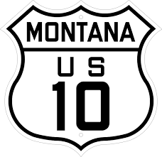
Highway 10 had two unique qualities about it. First of all, it did not go from the Atlantic to the Pacific, it actually began in downtown Detroit. It ran up in a north-north-western direction until around Bay City, then cut west to Lake Michigan. From there, a ferry would take people acruss the lake and continue on U.S. 10 in Wisconsin, continuing to Minnesota, North Dakota, Montana, Idaho, and Washingon, terminating in Seattle.
Much of 10 was easy travel as far as Montana before it crossed the Rockies in western Montana and Idaho. It alos had to cross the Cascade range in western Washington.
As of now, U.S. 10 exists only between West Fargo and Bay City, having been replaced with Interstates 90 and 94.
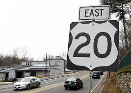
This road also has a unique quality or two about it. Not only was it extended from its original terminus in Yellowstone National Park to Newport, Oregon, but within Yellowstone itself, it does not exist officially. Therefore, 20 with the exception of its Yellowstone break, goes from Boston to the Oregon coast, traveling across Massachusetts, New York, Pennsylvania, Ohio, Indiana, Iowa, Illinois, Iowa, Nebraska, Wyoming, a tiny corner of Montana, then Idaho and finally Oregon. U.S. 20 sees quite a variety of landscape, from the rolling hills of the northeast through the northern Appalachians, farmland, urban areas of Boston, Cleveland, and Boise, and a good amount of desert in Wyoming, Idaho, and Oregon. It is also the main streen of several smaller towns in many states.

A coast to coast highway like U.S. 20, U.S. 30 does NOT get broken up by a national park. Much of 30 between Pennsylvania and Wyoming is labeled on maps as the Lincoln Highway, though with its many freeway bypasses around towns, particularly in Pennsylvania and Ohio, 30 has long strayed from the Lincoln Highway as it was originally routed.
U.S. 30 begins in Atlantic City, New Jersey (Monopoly, anyone?), and goes across Jersey, the long length of Pennsylvania, 3 miles of West Virginia at its most northern tip, Ohio, Indiana, Illinois, Iowa, the long length of Nebraska, Wyoming, Idaho, and Oregon, ending in Astoria. In fact, it takes some extra length between POrtland and Astoria by following the westernmost portion of the Columbia River.
Unlike U.S. 20, 30 has undergone many freeway bypass realignments in order to avoid smaller towns, particularly in New Jersey, Pennsylvania, and Ohio, thereby taking away the rural and small town charm it once had, particularly going through Pennsylvania Dutch Country. Before the arrival of the PA Turnpike, U.S. 30 was considered the safer of two routes (the other being U.S. 22) crossing the Appalachian Mountains. In fact between the western Pittsburgh area and the Philadelphia area, the turnpike and 30 are never more than a half hour apart.
U.S. 30 sees the downtown areas of Boise, Pittsburgh, and Philadelphia. Like 20, it sees many types of terrain on its course.

U.S. 40 actually shares an origin with U.S. 30, in that it begins in Atlantic City. From there it is a bit more southerly, crossing southern Jersey into skinny Delaware, then Maryland, Pennsylvania, a tiny bit of West Virginia, Ohio, Indiana, Illinois, Missouri, Kansas, Colorado, and ending in Park City, Utah, just 30 miles short of Salt Lake City. U.S. 40 shares a good amount of pavement with Interstate 70 between Baltimore and the Rockies, though it maintains its own identity in that distance in many places. Near Idaho Springs, Colorado, 40 "breaks up" with 70 permanently to cut up into northern Colorado and northeastern Utah.
U.S. 40 has an asset (or disadvantage depending on your point of view) of going through many downtowns, such as Denver, Kansas CIty, St. Louis, Columbus, and Baltimore. It sees a good amount of mountainous terrain in the east and west along with desert, coastal plain, and farmlands of the midwest.
Like U.S. 10, 40 fell victim to the Interstate Highway System, but unlike 10, it lost less than a thousand miles. Interstate 80's completion made 40 obsolete through western Utah, Nevada, and California, where it ended in San Francisco.
And finally, we will tackle the ever so famous...

U.S. 50 is about as classy a highway as they come, quite frankly because it's often the road less traveled...but I'll get to that in a bit!
Like 40 and 10, 50 suffered some truncation, but only about 100 miles or so. Parts of it originally were part of the Lincoln Highway in the west, particularly between San Francisco and Ely, Nevada.
Its truncation happened in Sacramento, so 50 does not see the Pacific Ocean.
Starting in Ocean City, Maryland, 50 crosses coastal plain to the Chesapeake Bay where it serves Annapolis via freeway and soon after, goes right through Washington,D.C. Actually, D.C. is about as downtown as 50 gets in terms of big cities. From there, it heads through the expensive burbs of Virginia before it gets into rural Virginia, then West Virginia, with a tiny slice of western Maryland, Crossing the Ohio, we get INTO Ohio, cutting through that state's southern rural parts, then into Indiana and Illinois, Missouri, Kansas, Colorado, Utah, Nevada, and California.
Aside from D.C. downtown-wise, 50 sees Cincinnati and St. Louis. Apart from that, it sees a LOT of country, but maintains its own identity most of the way, key word is MOST!
Currently, between Grand Junction, Colorado and Salina, Utah, it shares a little over 200 miles of Interstate 70, going through some spectacular desert landscape. Before Interstate 70 was completed in Utah, 50 followed U.S. 6 from Green River to Spanish Fork, headed up to Salt Lake City, cut across with U.S. 40 to Wendover, then cut south to Ely, Nevada. Now, it goes from Salina to Scipio, follws Interstate 15 south to Holden ( a ghost town), then heads west to Delta to share road with U.S. 6 to Ely.
From Ely, Nevada to Fallon, Nevada, U.S. 50 is known as the Loneliest Road because there is not much for almost 300 miles. Most truck travel prefers Interstate 80 to the north, and the towns of Austin and Eureka are not known as travel destinations. It is a fascinating and often scenic combo of desert and mountain...as is most of Nevada in fact.
West of Carson City, 50 does some climbing and dropping before it enters the Lake Tahoe area, offering many stunning views of the beautiful blue deep lake, then does some more mountain climbing in the Sierra Nevadas before it becomes a freeway to serve the greater Sacramento area and end at Interstate 80 in West Sacramento. In its pre-Interstate days, 50 cut south to Stockton, then went west again through the golden hills of Altamont before entering the vast east bay collection of cities before crossing the San Francisco Bay itself to end in the city.
No comments:
Post a Comment